Barcelona to Cape Town
November 18 to December 13, 2023
Mike and Judy Henderson
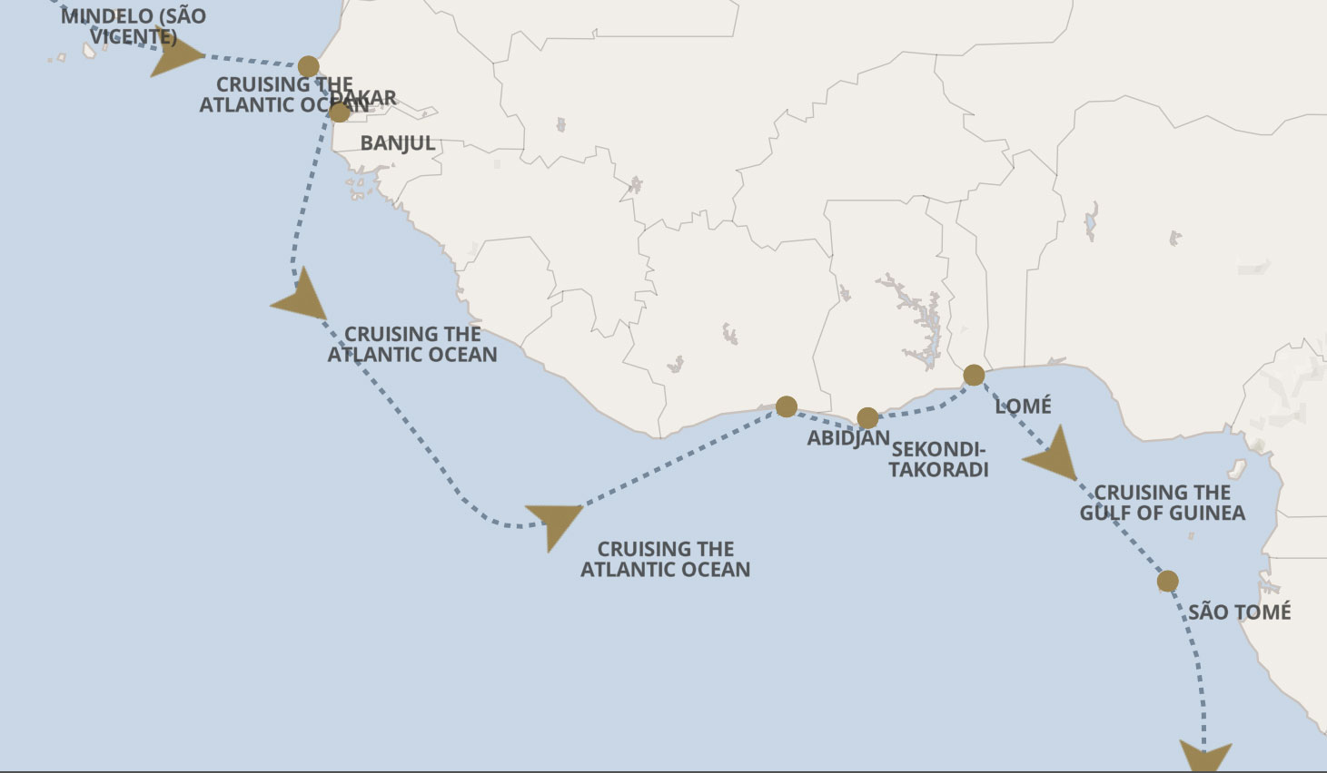
In the last installment we were in Banjul. We've left Banjul and have two "sea days" before we reach Abidjan, Cote d'Ivoire (or Ivory Coast).

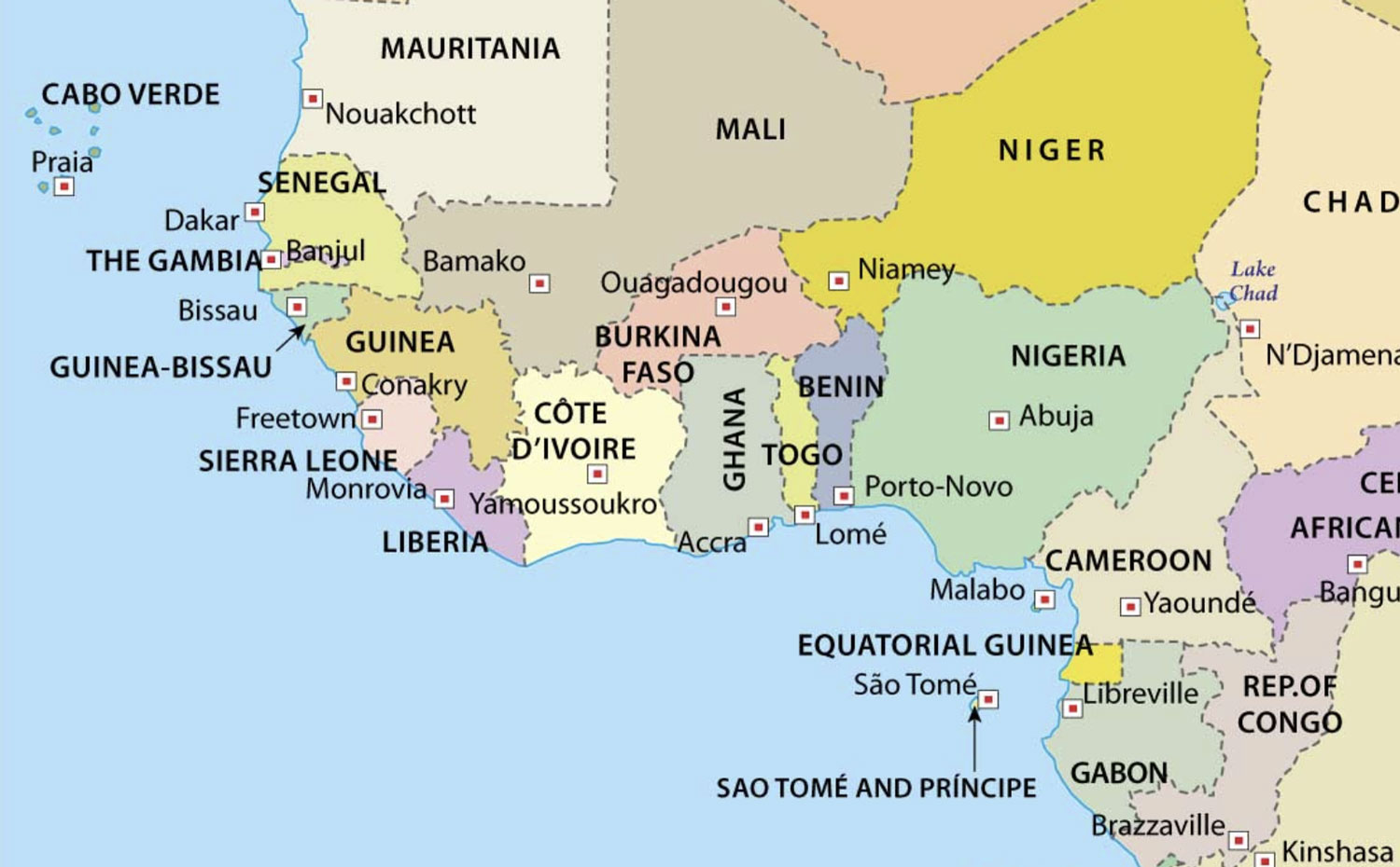
Here's a map of this part of Africa.
+++++++++++++++++++++++++++++++++++++++++
11/30/2023 (Thursday) Sea Day. The ship offers lectures, games, bridge lessons, boutique presentations, lounge shows, an afternoon tea, and other activities. We had a quiet day, but usually show up for a couple of deck games and the trivia session.
+++++++++++++++++++++++++++++++++++++++++
12/1/2023 (Friday) Sea Day. We're at about 4.5 degrees north latitude today, but we won't cross the equator until we get to São Tomé . We will cross the prime meridian as we sail to Lomé, however.
The location where the prime meridian and the equator cross is known as "Null Island", an imaginary island in the Gulf of Guinea. We will not cross that point.
It's traditional to hold a King Neptune's Court when a ship crosses the equator (also see here and here). Judy and I are both Shellbacks from our Galapagos trip so we won't have to go through the court. The court is for Pollywogs, those people who have never crossed the equator on a ship.
You can only be a Shellback if you've crossed the equator on a ship. Crossing it on an aircraft flight does not count.
At the end of dinner tonight, I noticed a bit of a sore throat and just hoped it would disappear by morning.
+++++++++++++++++++++++++++++++++++++++++
12/2/2023 (Saturday) We arrive at Abidjan, Cote d'Ivoire this morning. My sore throat has gotten worse.
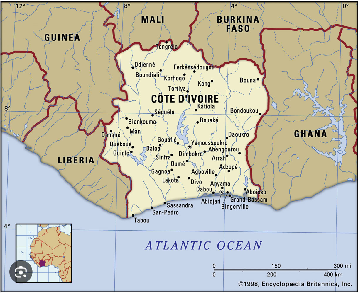
Back in the Colonial period, certain areas of Africa were given names that referred to the product shipped from that area. So you had the Ivory Coast, the Gold Coast (Ghana), and the Slave Coast (Togo). The countries that had those names changed them when they obtained independence, except the Ivory Coast.
The Ivory Coast was French and they have retained their "Coast" name and its French spelling: Cote d'Ivoire. French is the official language, and the major religions are Islam and Christianity.
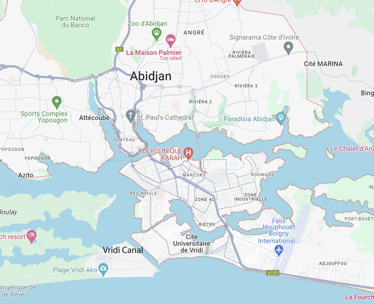
The city of Abidjan is an important port for Cote d'Ivoire, but it was only after the Vridi Canal was created in 1950 that it was possible for large ships to enter the harbor.
Cote d'Ivoire was named because the area had a large population of elephants. With the demand for ivory by the Europeans, the local people began killing the elephants for their ivory. Today, there are very few elephants in Cote d'Ivoire. In addition to poaching (killing of the elephants for their ivory), there just isn't much forest for the elephants to live in. There are probably less than 350 elephants in the whole country, Here's a study about the elephants in Cote d'Ivoire.
We came in through the Vridi Canal after dawn. There's nothing special about the canal, itself, but along the canal was an almost unbelievable slum. Here's an overview picture and a closer look.
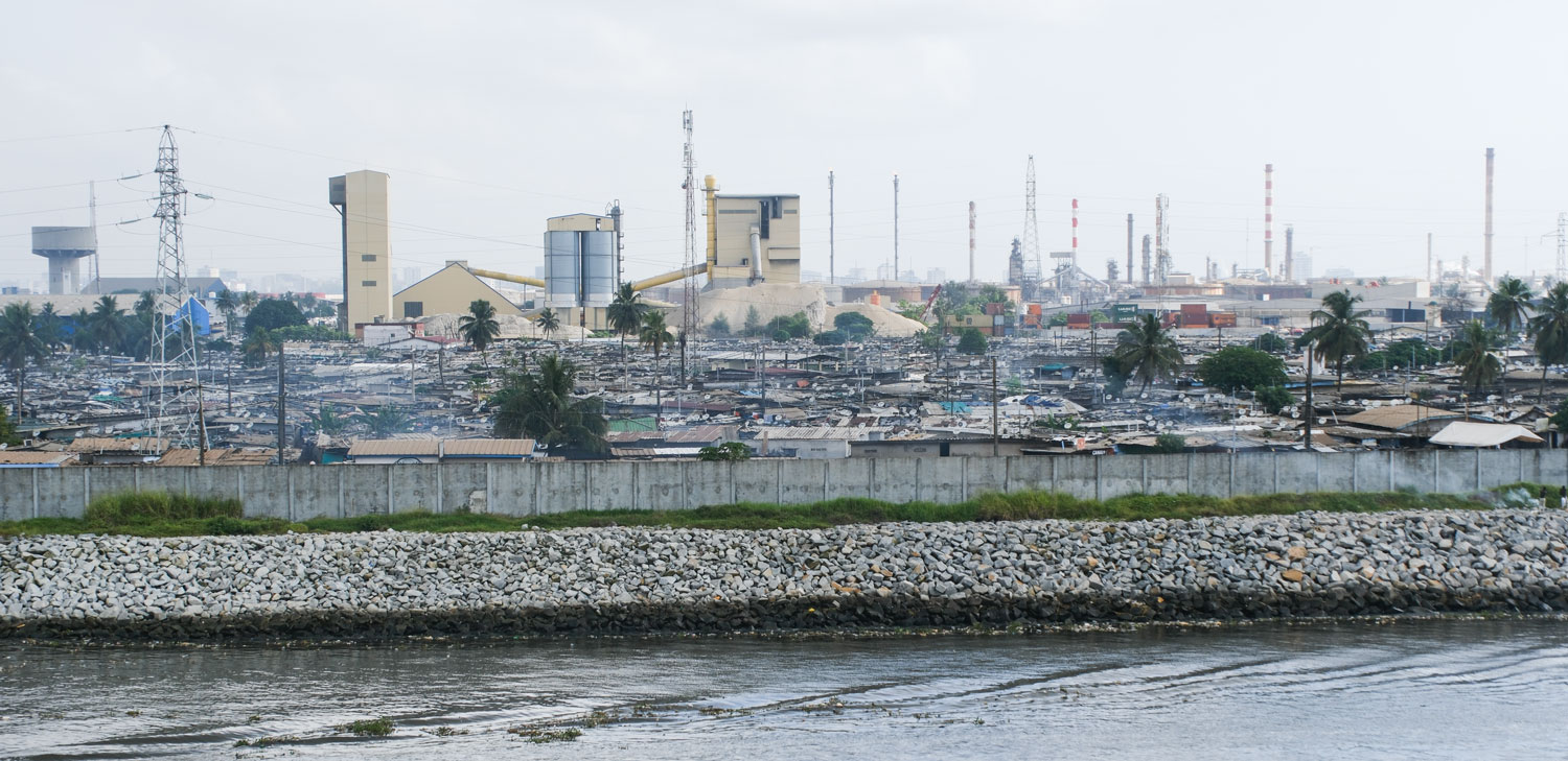
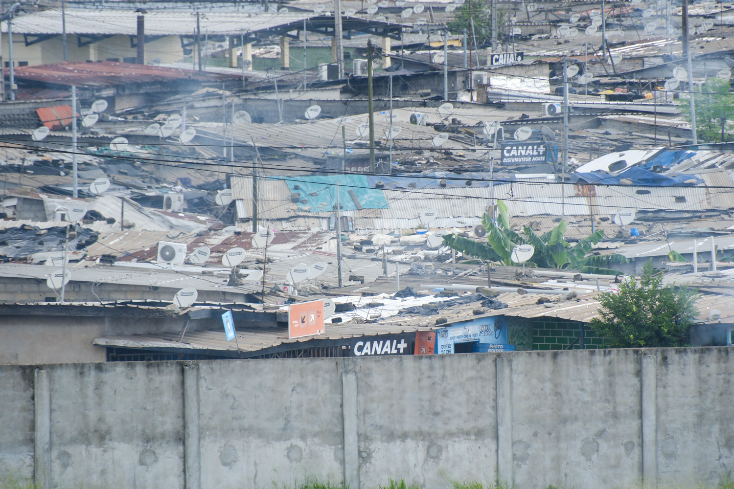
Shacks are roughly built from whatever they could obtain. And it was quite large. The overall picture is just of a part of the slum.
Judy and I had seen similar slums in Soweto, South Africa and these were built in a similar fashion.
We were to find out later that slums were very common in the city. I'll talk more about it later.
We have a long (8 hour) excursion today. The bus was Chinese made, Yutong, and had three seats on one side and two on the other. The seats were small and the people who took the 2-seat side were tight. Judy and I got a 3-seat and had some space between us.
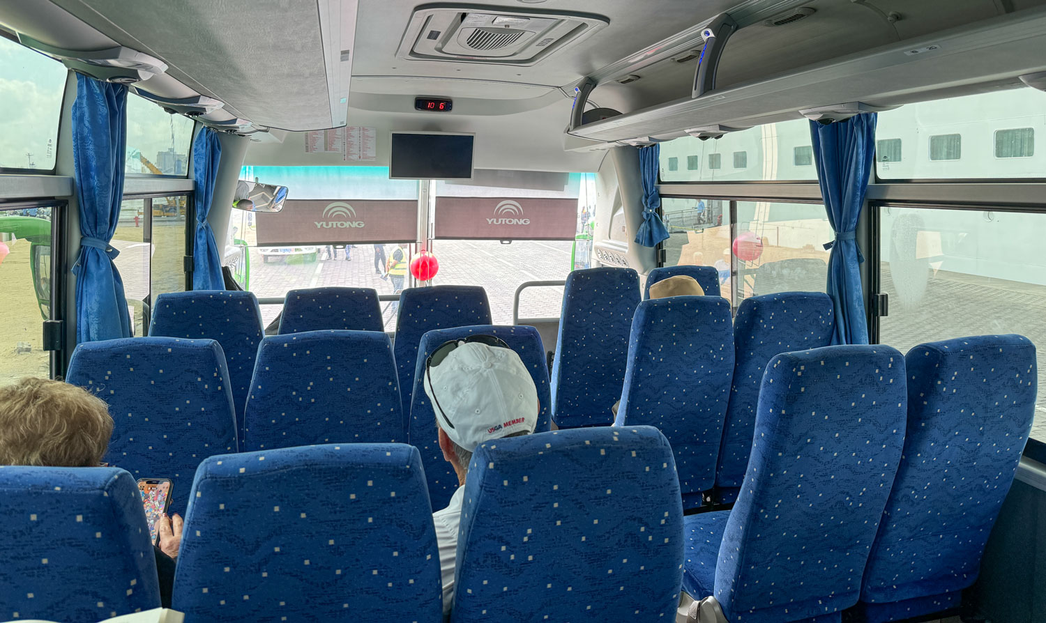
I'm not sure if it was because of the security issues, but we had an escort of three policemen on motorcycles. But many of the buses were included in the excursion. In fact, I think there were only two excursions offered.
But if it wasn't for security, the police helped a lot by clearing traffic so our buses could get through and could stay together. They took us through red lights, for example, and cleared passages for us through congestion.
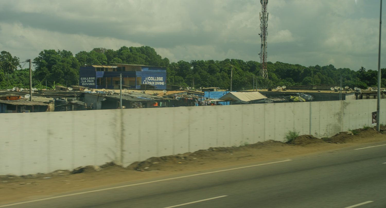
Our excursion was to Grand-Bassam, a town east of Abidjan. We took the A100 road along the coast from Abidjan to Grand-Bassam. It was along this road that we saw the slums. It was hard to get a good picture because they have built a concrete wall between the road and the slum. The thing that a picture cannot convey is how big the slum is. It goes on for miles. It's interrupted by the airport but continues on the other side. It's much larger than the slum in Soweto.
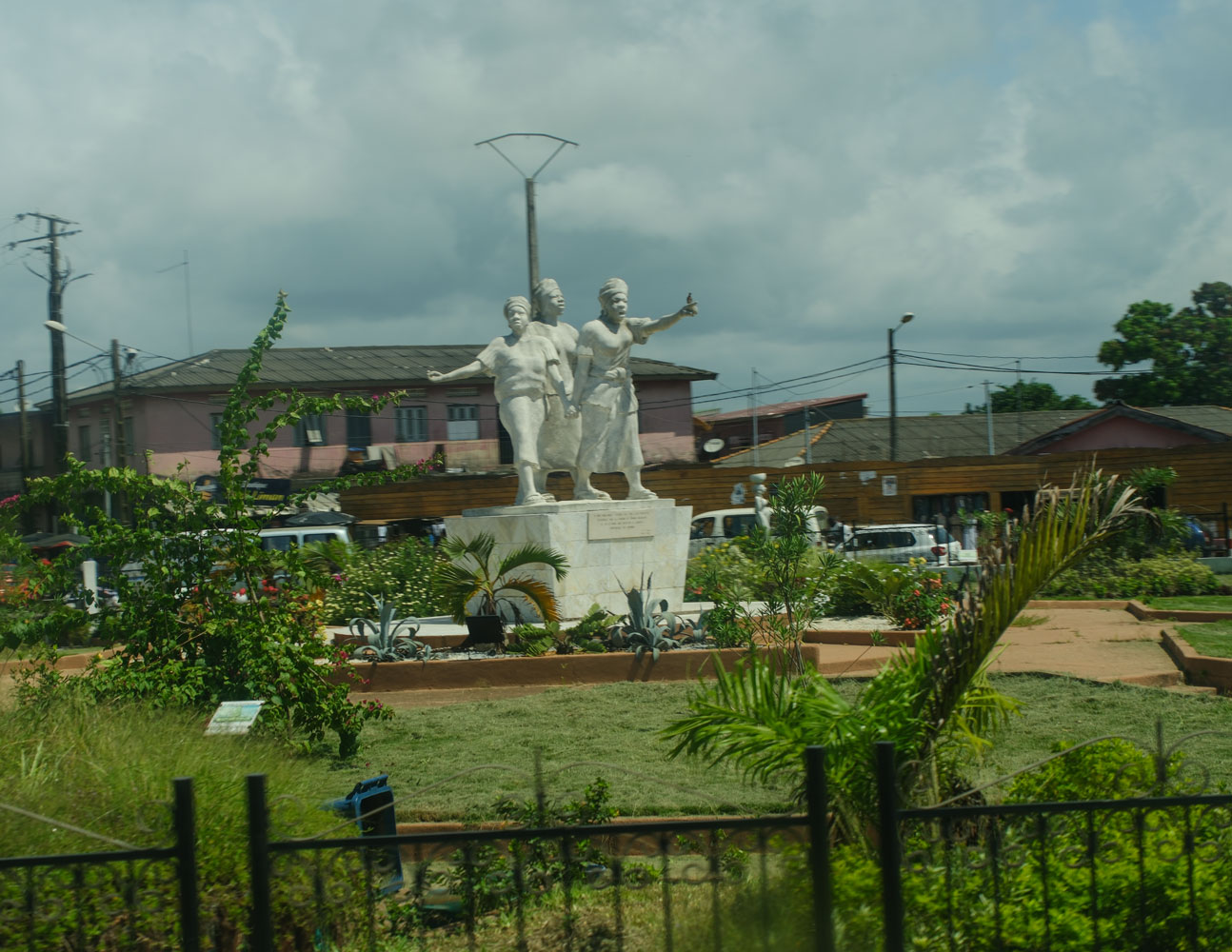
When we got to Grand-Bassam, we passed the Place de la Paix, which commemorates a 1949 women's march from Abidjan to Bassam to protest the incarceration of their husbands and sons for anticolonial activities.
The took us to a large handicrafts store.
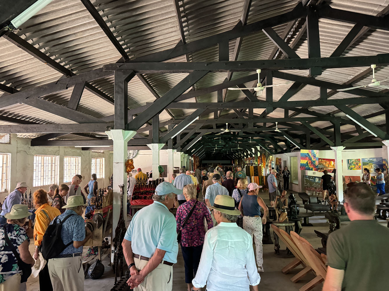
Colorful fabrics.
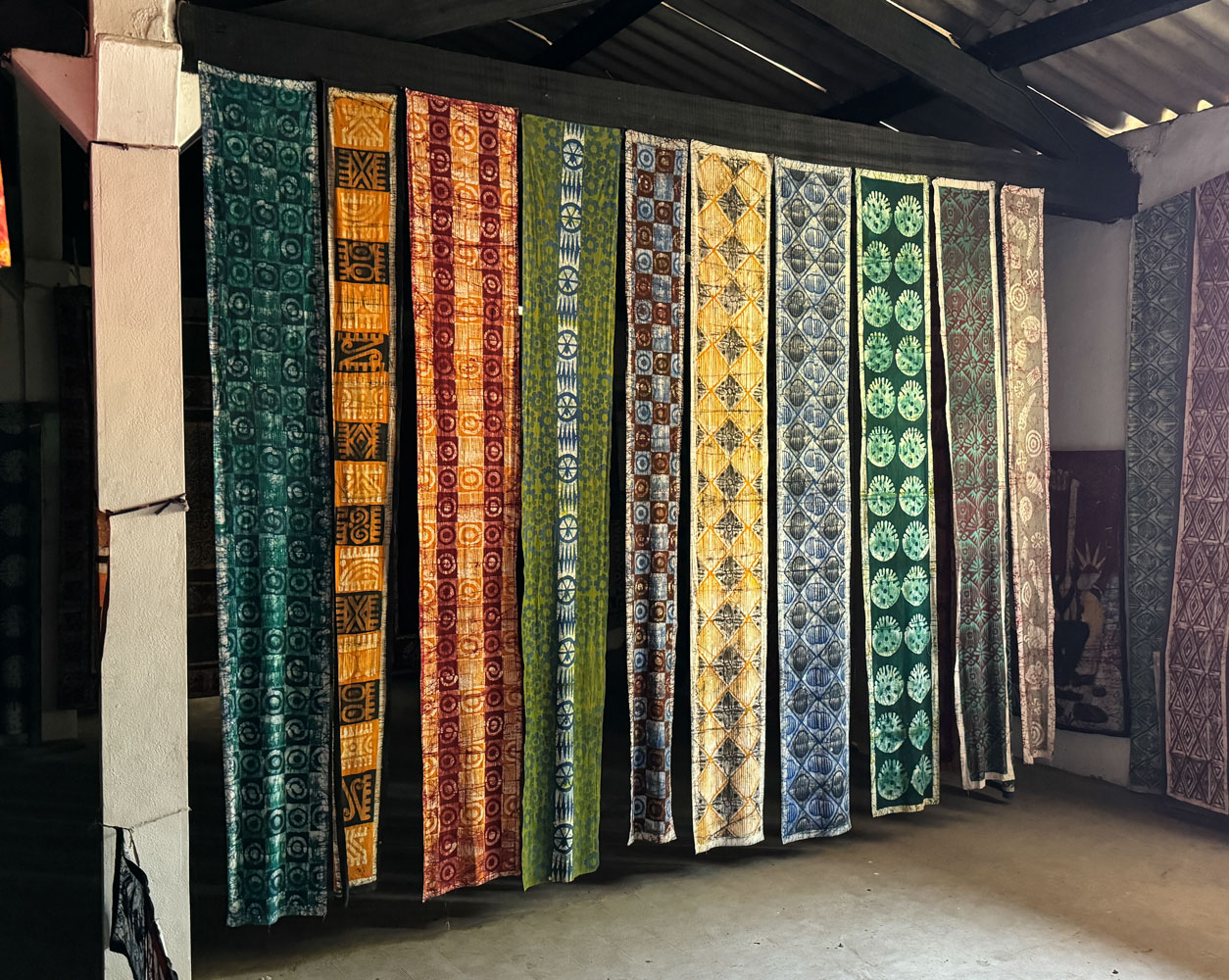
Lots of fabric.

Fabric art.
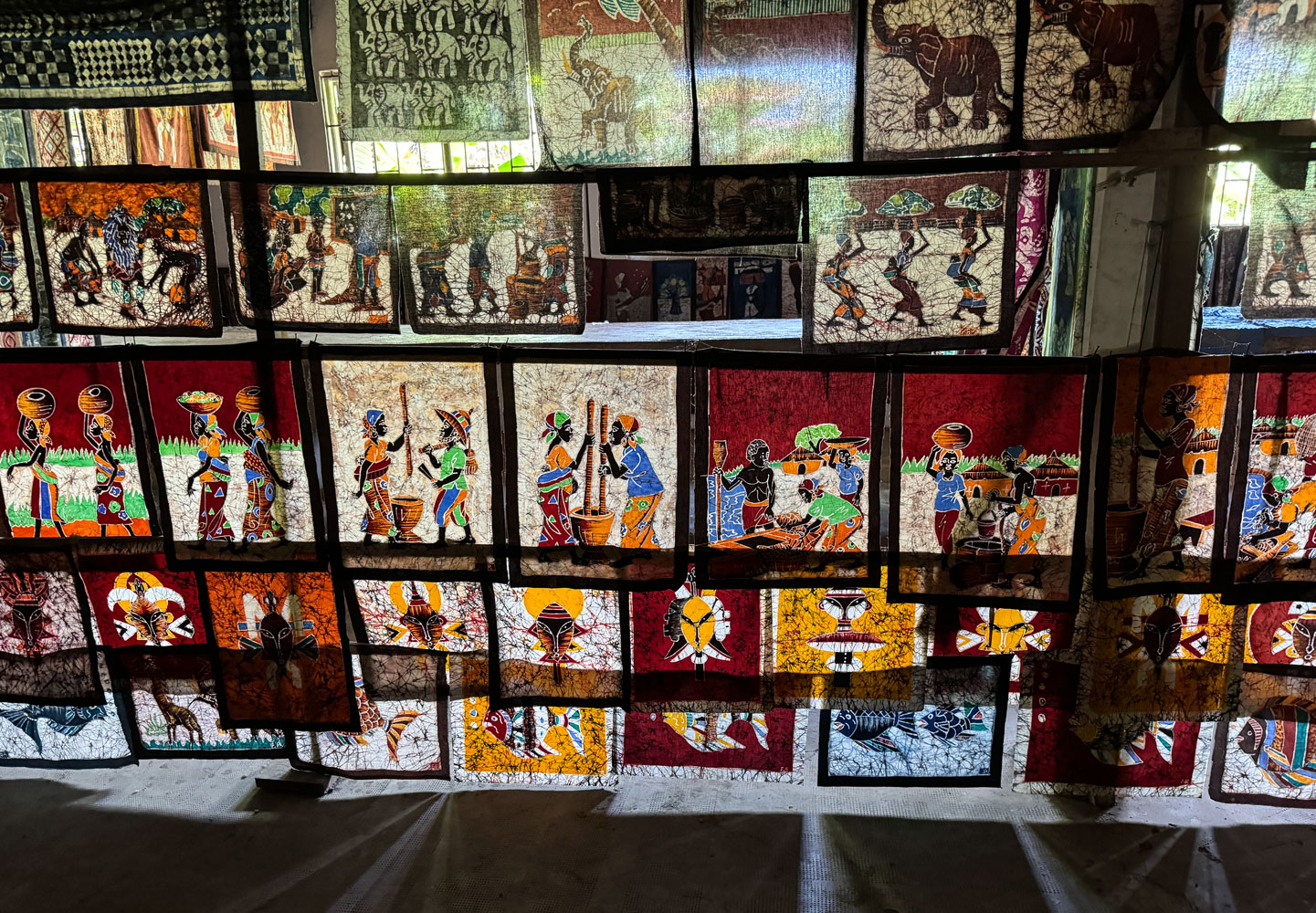
More fabric art.
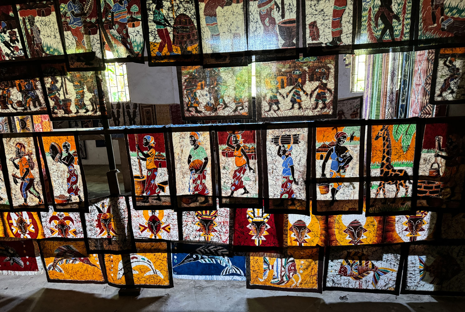
I didn't see a lot of sales. The art may not fit into western homes, and it has to be packed home.
Next, they took us to the National Costume Museum. I didn't take any pictures in the museum.
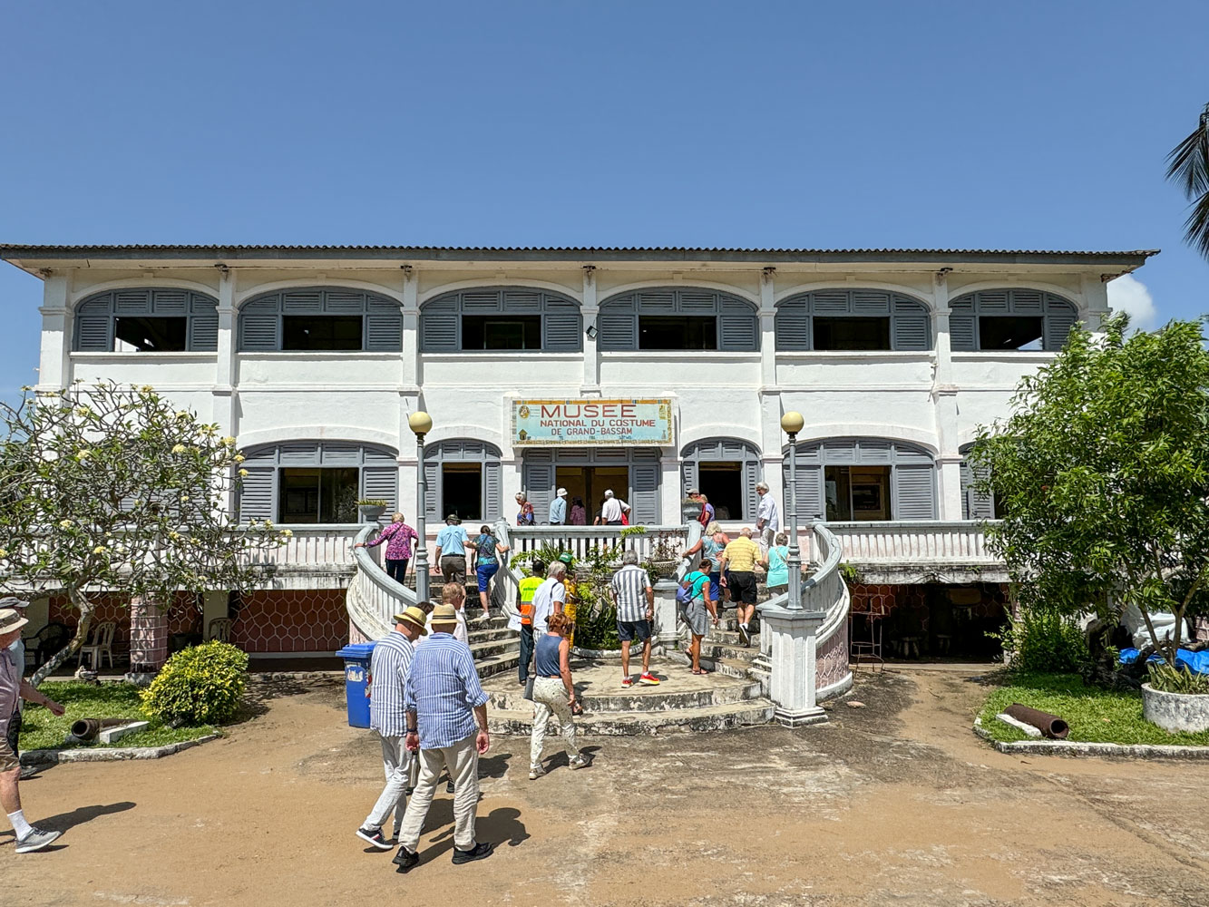
Attached to the museum was a gift shop (of course) and they routed us through that when we left.
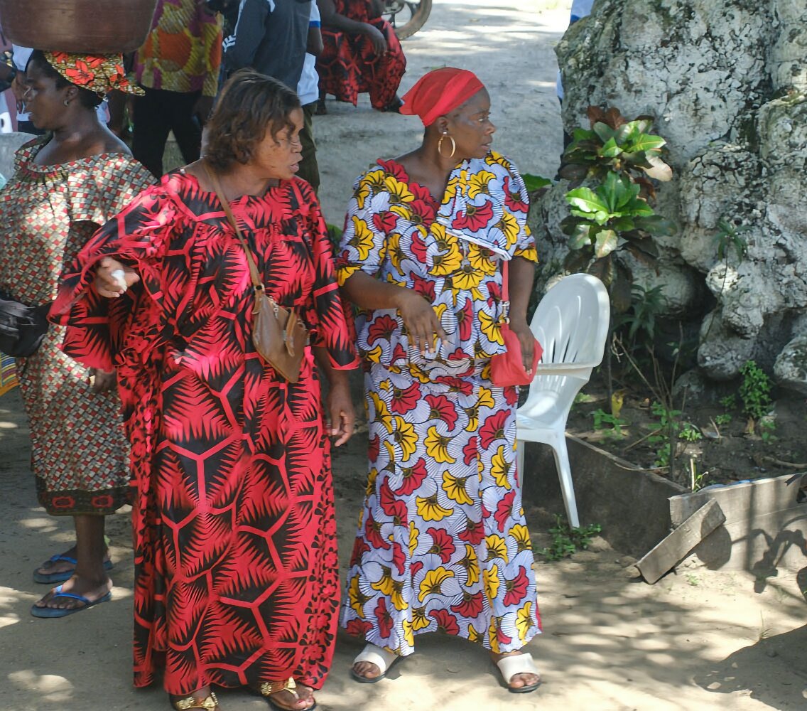
As we left, we passed a church, and these two women were in their Sunday best.
By now it was about lunchtime, and we stopped at a modern hotel and restaurant. The restaurant had many long tables set up outside under cover. Although it was outside, the temperature was comfortable.
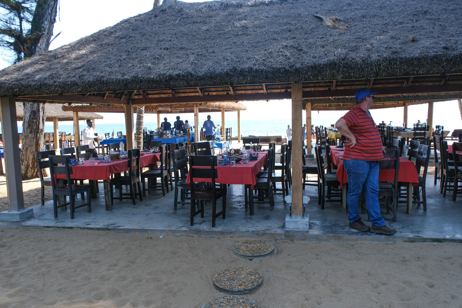
Our table. Not in the picture, but it bordered a narrow sandy beach and the gently lapping Atlantic.
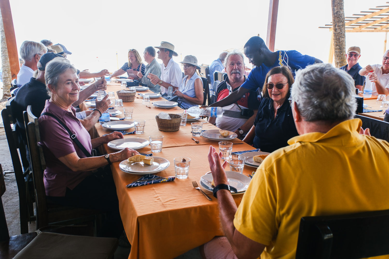
They served boiled shrimp, salad, rice, couscous, tuna salad, and a dish of fish. Then a coconut torte for dessert.
After lunch we went to the other side of Abidjan, which the guide described as the expensive side. He said Europeans and rich Abidjani's live there.
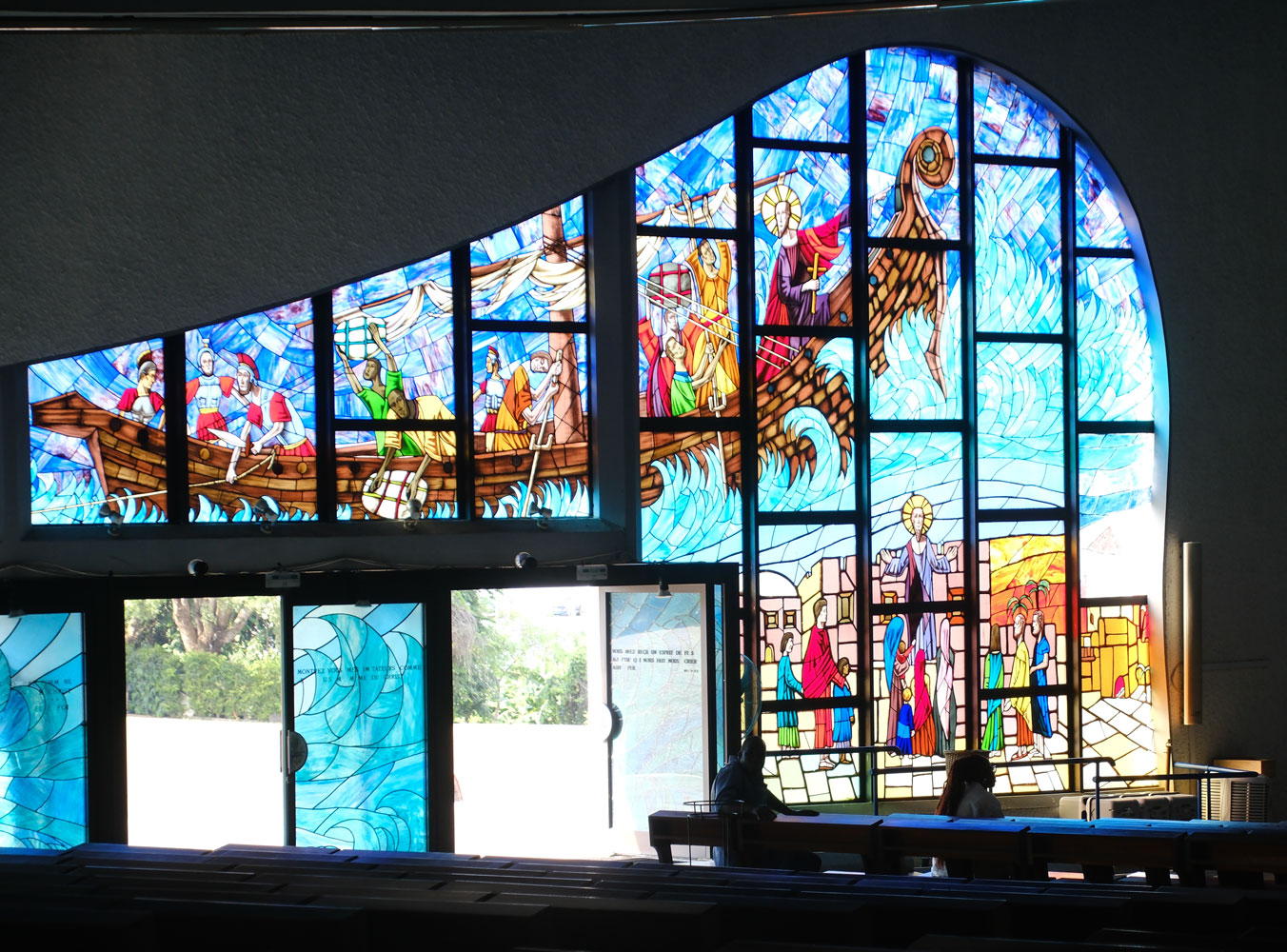
We went to St. Paul's Cathedral located there. It's huge. It can accommodate up to 5,000 people, with 3,500 seated.
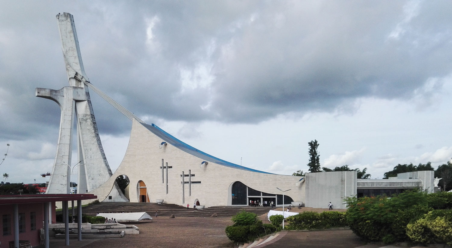
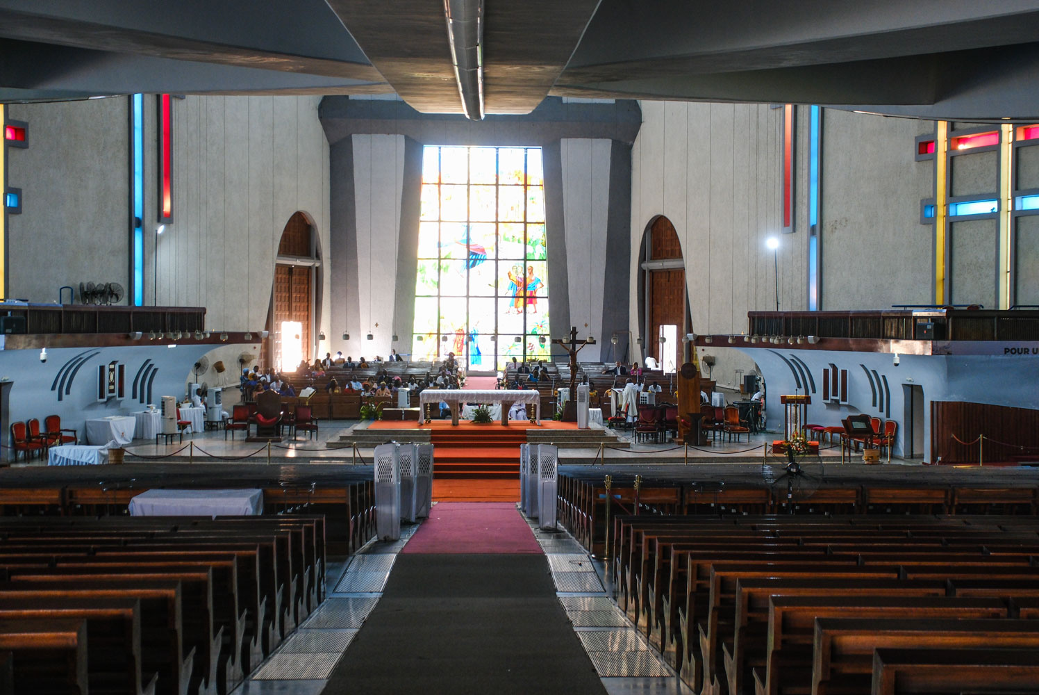
It was completed in 1985. Here are a few interior views. The altar area.
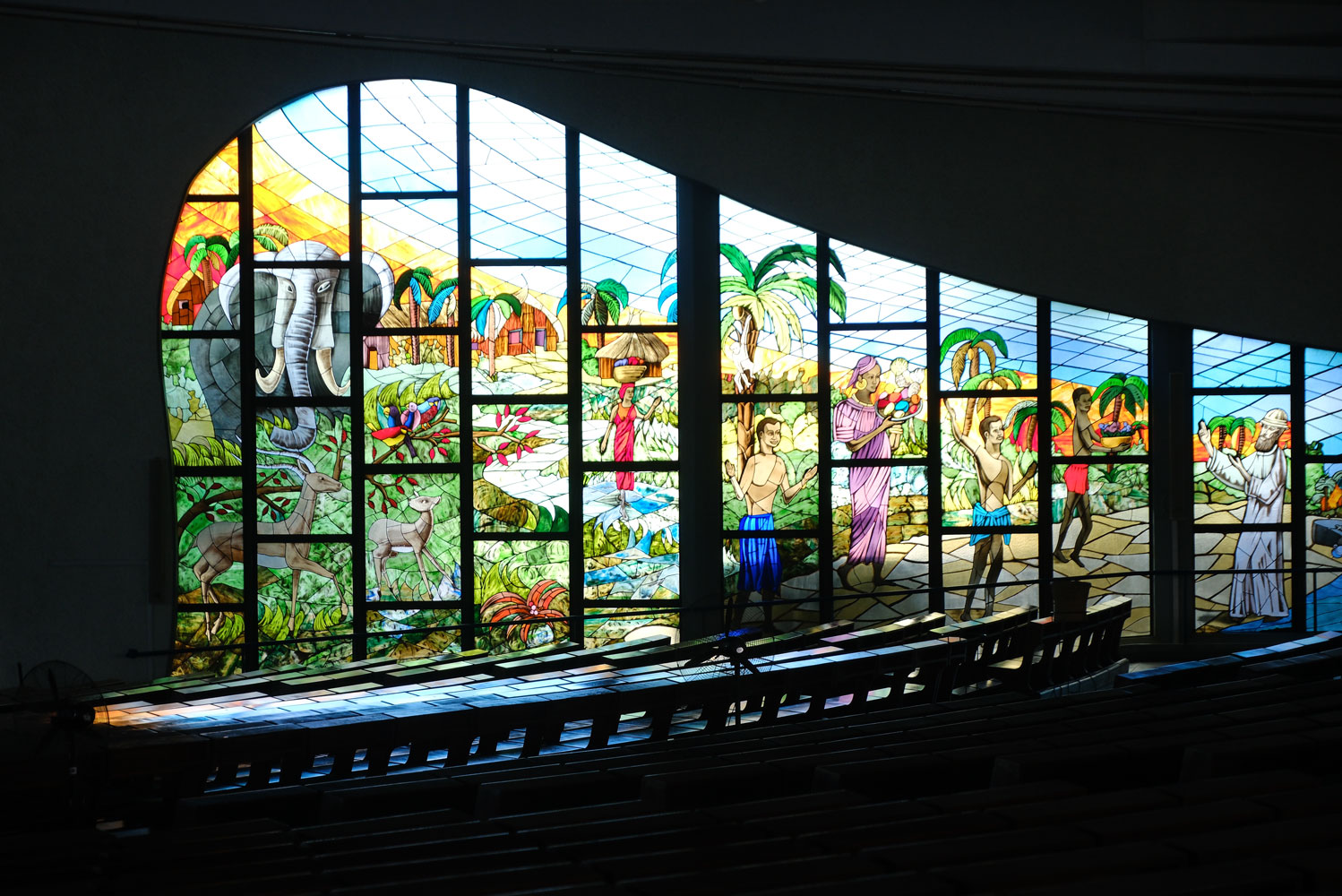
Some of the glass.
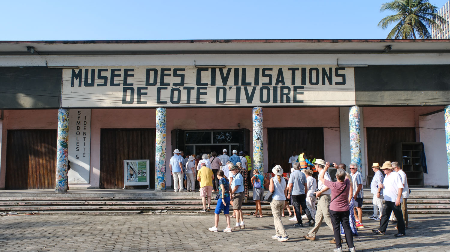
From the church, we went to the Musee des Civilizations, which addressed the groups that lived in Cote d'Ivoire over time. It was not much of a museum and it was too crowded, with the 5 or 6 buses that we had.
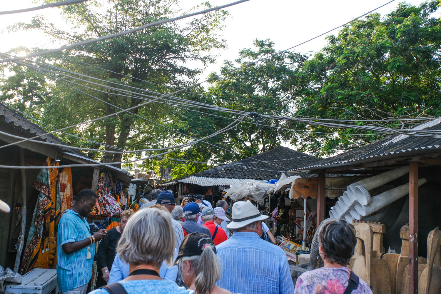
Finally, they took us to another handicraft place, "so we could get a souvenir of Cote d'Ivoire".
Here we are entering the handicraft place. I chose this picture because it shows the haphazard electrical wiring between the buildings.
Another view of the handicraft place.
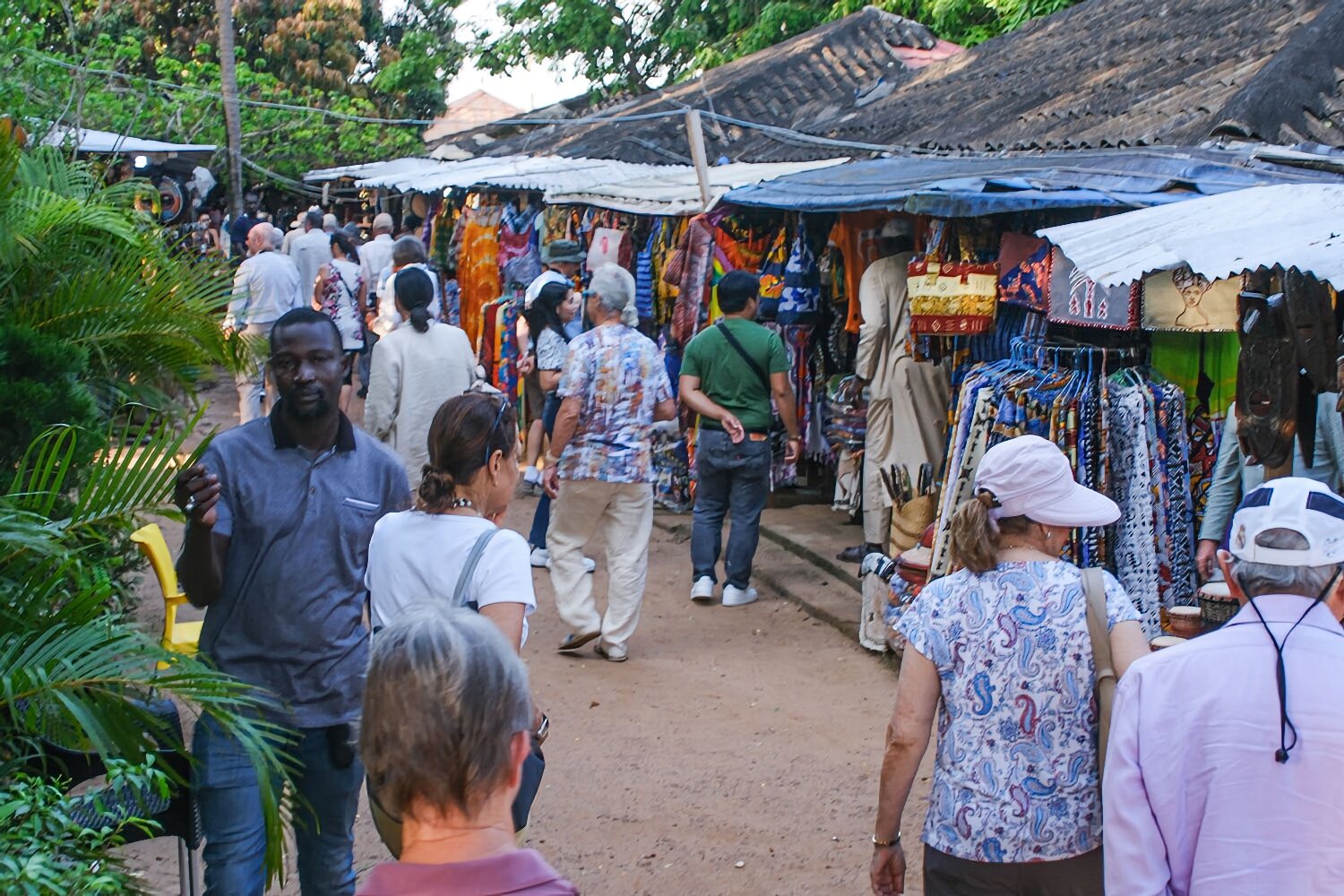
The problem with these places is that they all have the same products, so it's obvious that the things are produced in volume somewhere (China?) and sold to the vendors for sale to the tourists. I don't blame them, because real hand crafted products would have to be sold for a higher price and tourists are generally looking for low cost.
The vendors appear to know that the quickest way to scare off a potential customer is to be too aggressive. They hawk their wares, but are not like the vendors in Egypt.
We arrived back at the ship fairly late, almost 6pm. The ship set up a buffet dinner because of the late arrival of the people from the excursions, and then we went to bed.
My cold is kicking up - I was okay during the day but started to really feel it by the time we got back to the ship. I went to bed immediately and slept all night.
+++++++++++++++++++++++++++++++++++++++++
12/3/2023 (Sunday) We docked in Ghana around 8:45 am. I woke up feeling sick, but our excursion was not until the afternoon, and my condition improved by noon. Our excursion was only about four hours, so we decided to go.
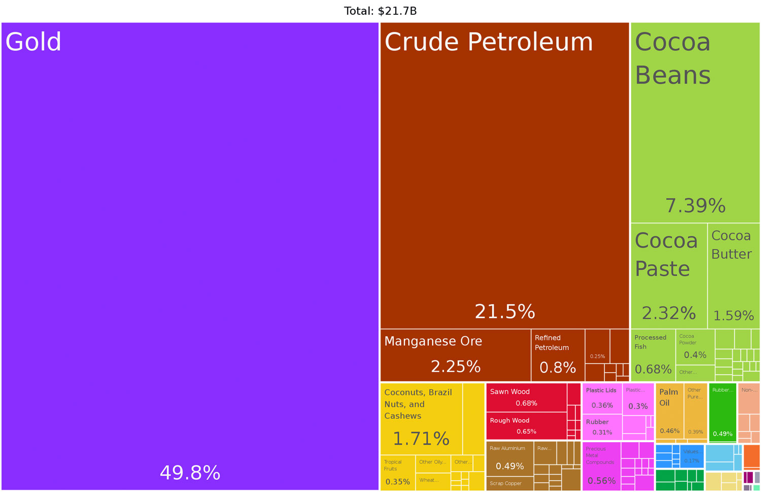
Ghana was known as the Gold Coast because gold had been discovered and mined there. As long ago as the 1400's gold was mined in small pits and panned along streams. In about 1874, British companies began mining for gold using heavy machinery. Most of the mines are in the south-western part of Ghana.
Gold is still a major factor in Ghana. See this graphic of Ghana's exports. It's the number one producer of gold in Africa, just slightly ahead of South Africa.
The official language of Ghana is English. The population is about 70% Christian and 20% Muslim.
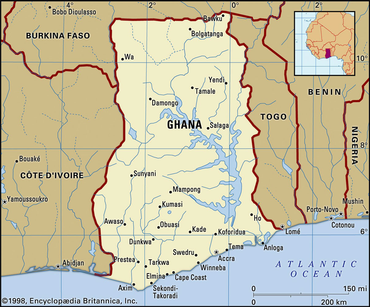
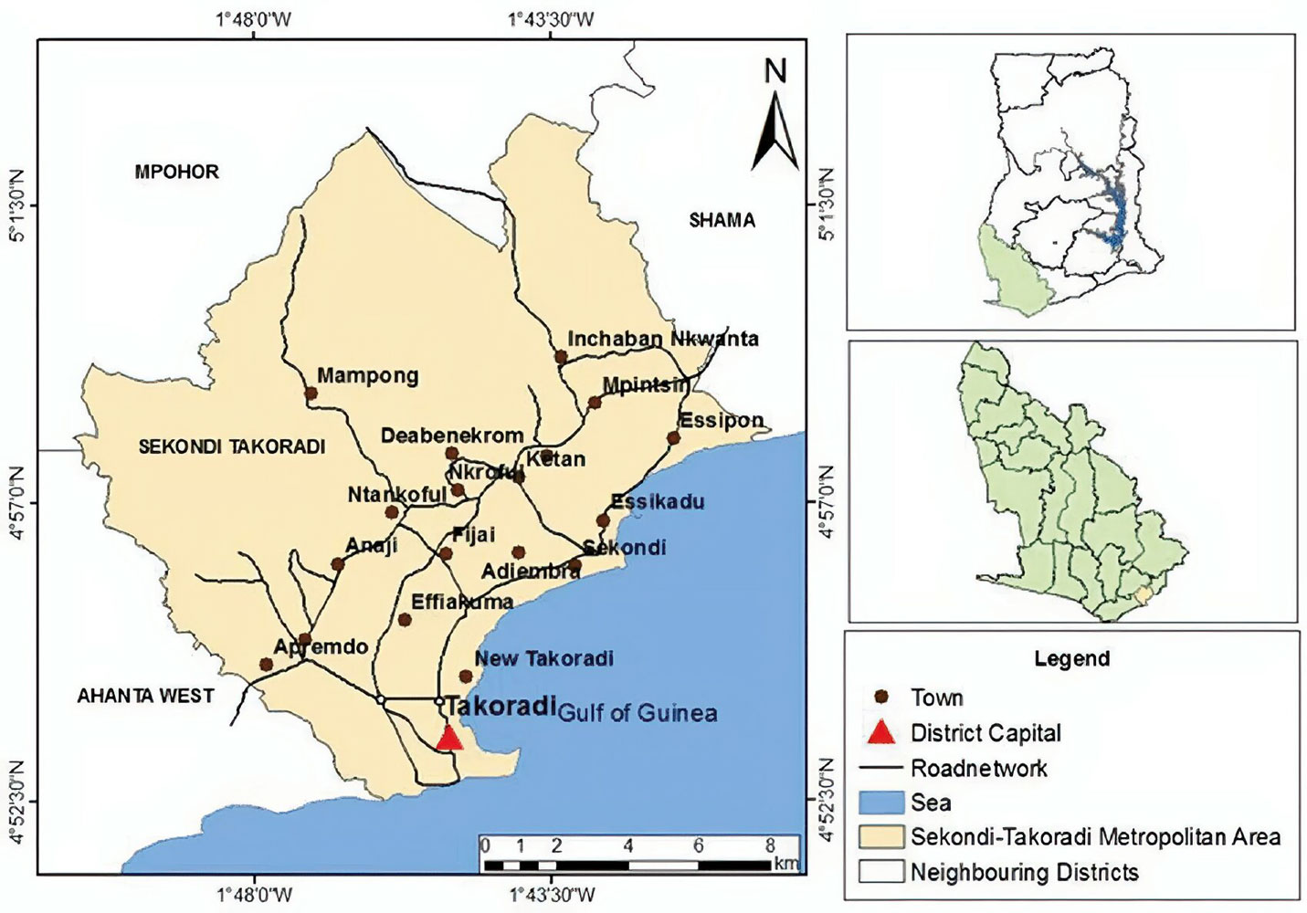
We're docked at Sekondi-Takoradi, in the south-western part of the country.
Our excursion is about four hours, so it will be limited in what they can show us of the country. We boarded the bus about 1:30pm and our first stop was a fishing port. I don't remember how many buses were involved in this tour, but we had a crowd.
While Ghana is not a rich country, it was obvious in driving through the city and countryside that it is not as poor as Cote d'Ivoire. We did not see any slums. There were small shops all along the roads, but they were in better condition than in Cote d'Ivoire.
It was Sunday and the fishermen were all in port. There were two docking areas of the port. One area was for these smaller boats and a second area was for larger boats.
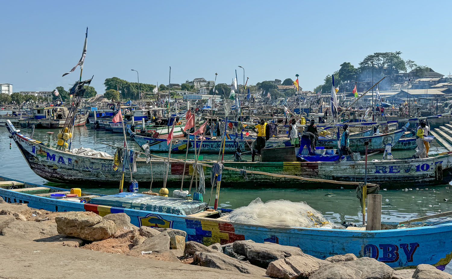
The boats are all wooden. As we drove in, I saw several boats being built from the local timber.
Here's a closer look at a couple of the larger boats. Note the enclosed wheelhouse - these boats probably go out further from shore.
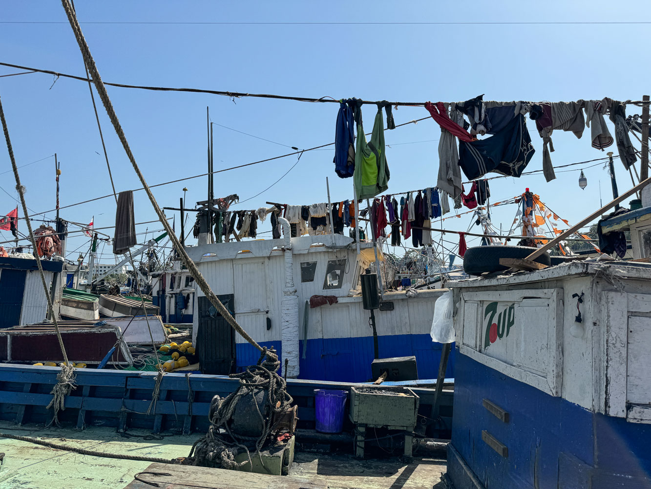
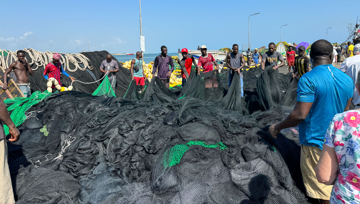
The fishermen work together to organize the nets for the next day's fishing.
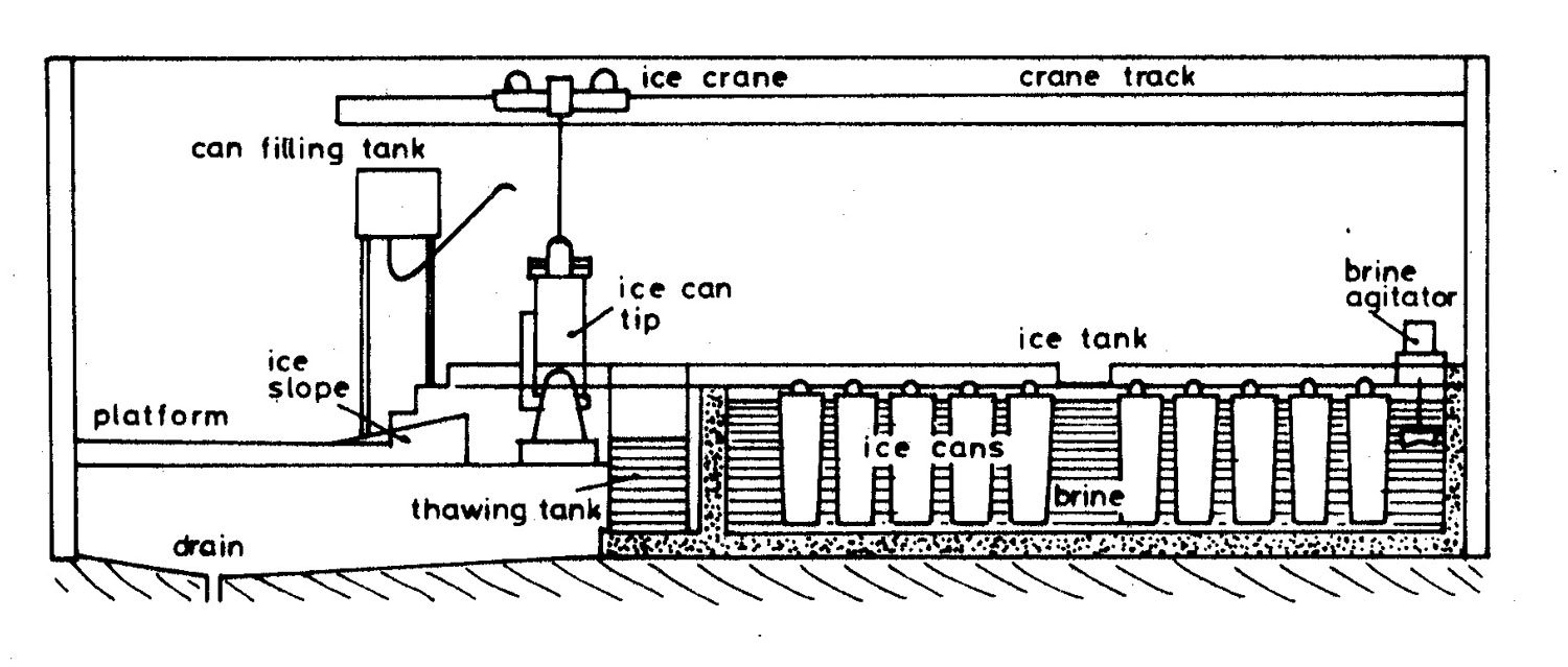
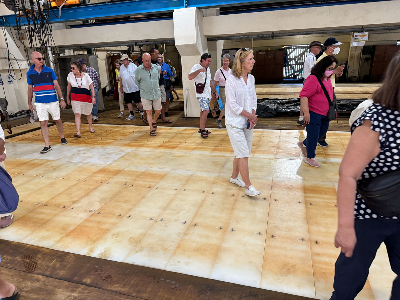
There is a block ice plant on site to produce ice for the fishermen to preserve their fish. A block ice plant consists of a tank of brine that is cooled to 10 to 20 degrees F. Tapered "trays" of pure water are lowered into the cold brine and the water is allowed to freeze. It's a slow process, taking up to eight hours to freeze a tray of water, so a block ice plant can usually only harvest ice about three times a day. The refrigerant is usually ammonia.
Pipes containing the ammonia are distributed throughout the brine tank and the brine is circulated to improve heat transfer. Here's a diagram to illustrate how a block ice plant works. Note that the "cans" are tapered to make removing the ice block easier. When the water in a can is frozen, the can is lifted and either sprayed with water or dipped into warm water to release the block from the can.
The technology is quite old - the first block ice plant was opened in New Orleans in 1868.
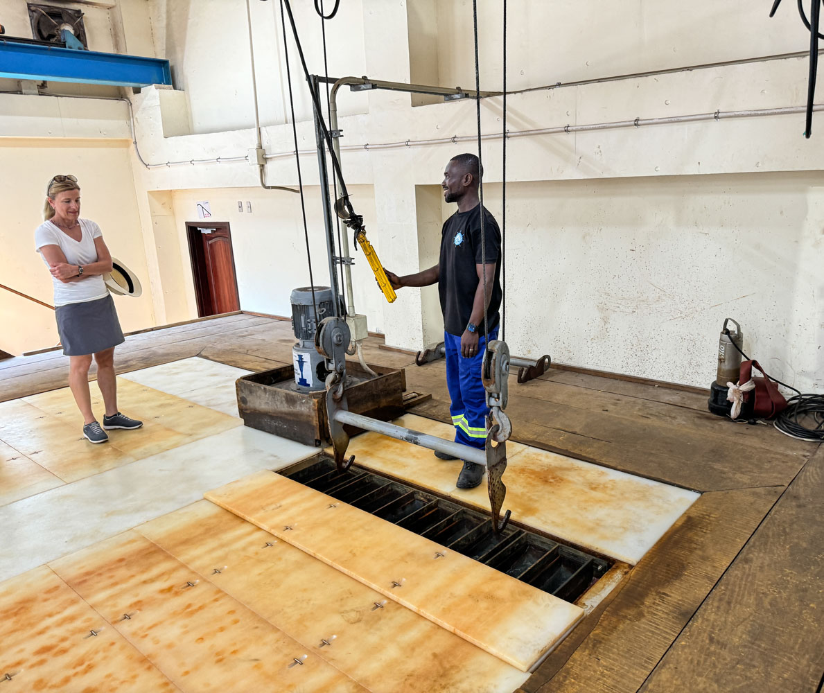
Here's a picture inside the block ice plant. The worker has just lowered a group of trays into the brine. Behind him you can see the brine circulating pump. The trays can be made almost any size, with the size being chosen for the intended use of the ice. When I was a kid, the local block ice plant produced blocks weighing 300 pounds.
It looks like this tray makes ten blocks of ice.
The trays are covered to keep the brine cold, and you can walk over them safely.
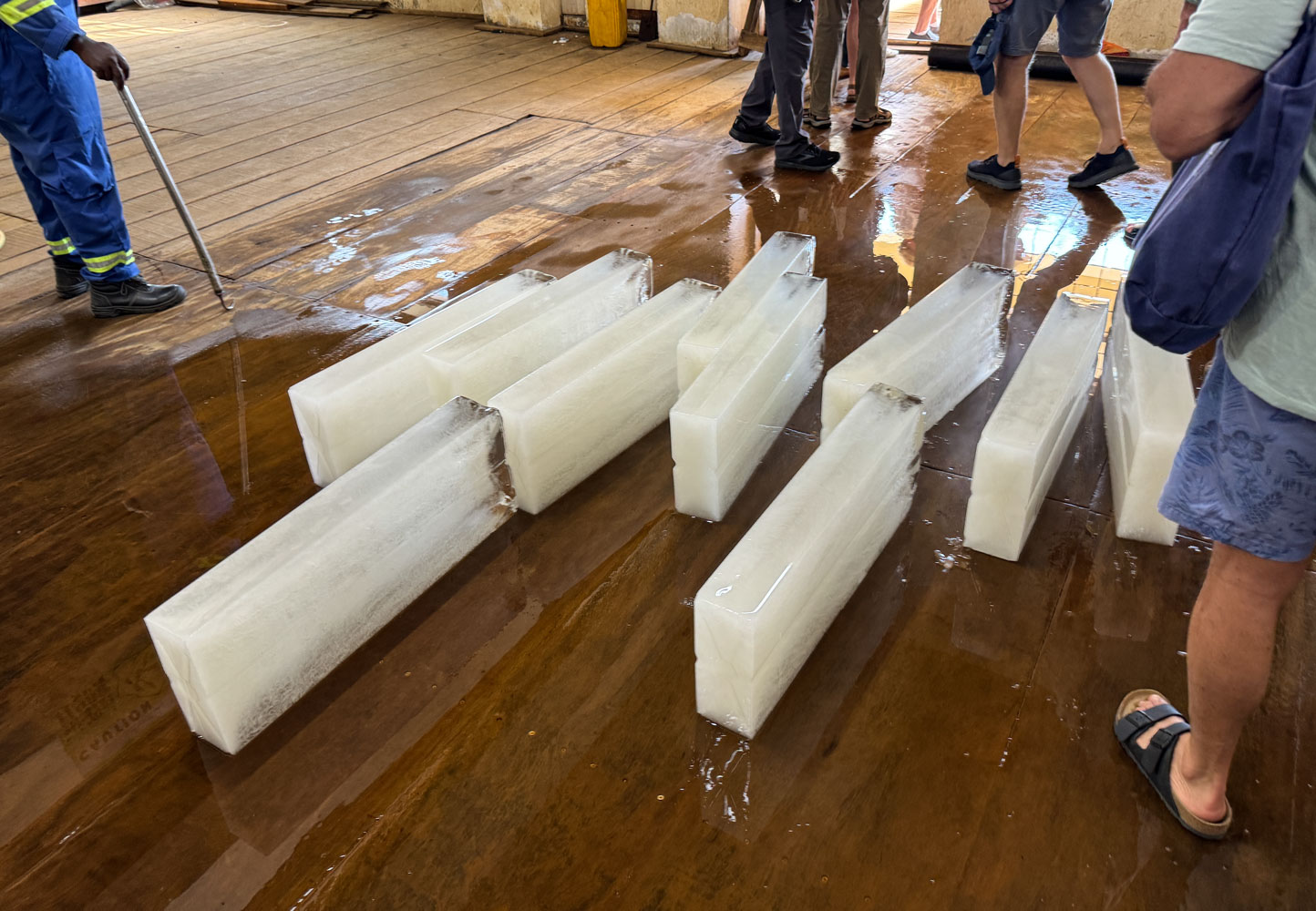
Some of the blocks of ice produced by the plant. I didn't get the weight of each block but they are smaller than the 300 pound blocks I remember.
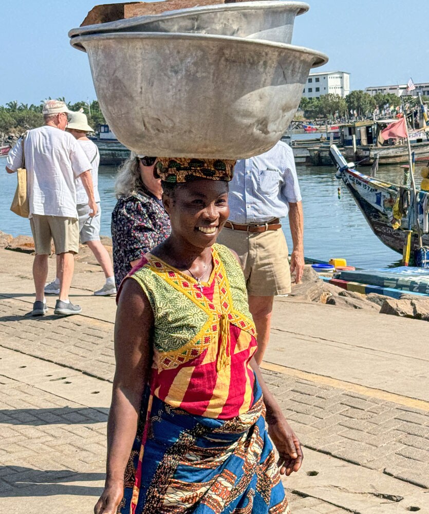
A woman balancing a load on her head. Note the cloth ring she has on her head, which helps provide a flat surface for the load, and helps her balance it. Carrying things this way was very common throughout this area, both by men and women, although we saw many more women balancing a load than men.
We left the fishing port and went to a modern hotel where a drumming and dancing exhibition was set up. Here's the band.
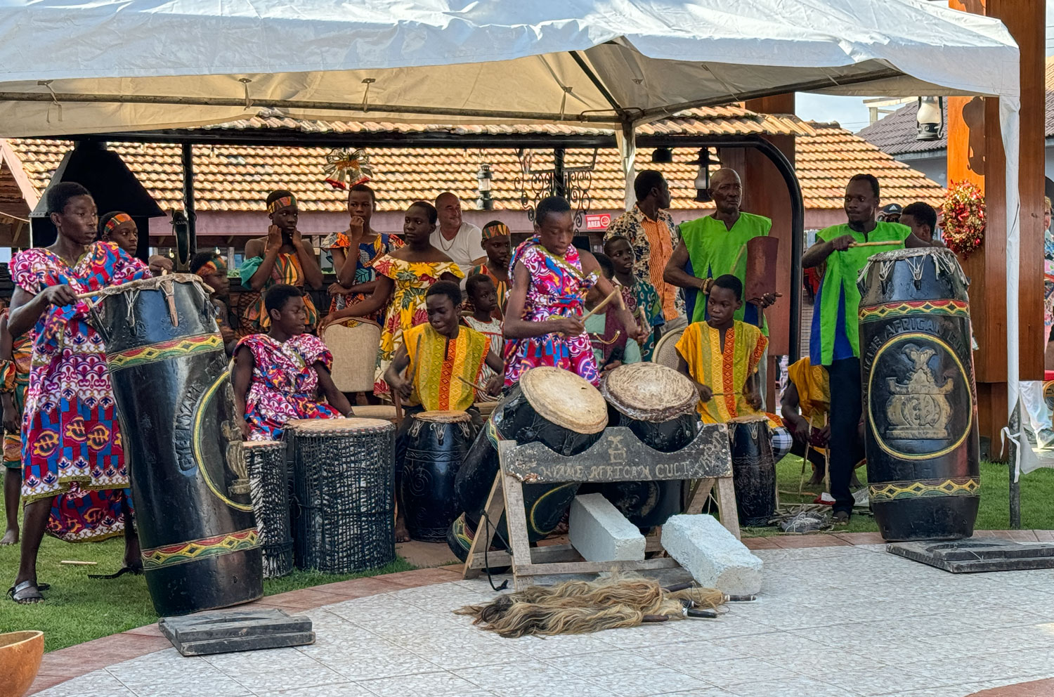
The drummers played for a while and then four dancers came out.
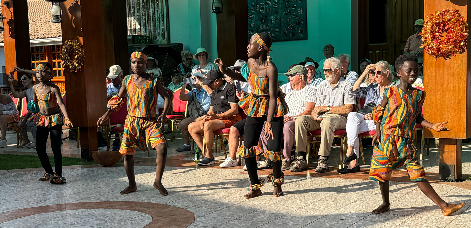
A closer view of two of the dancers.
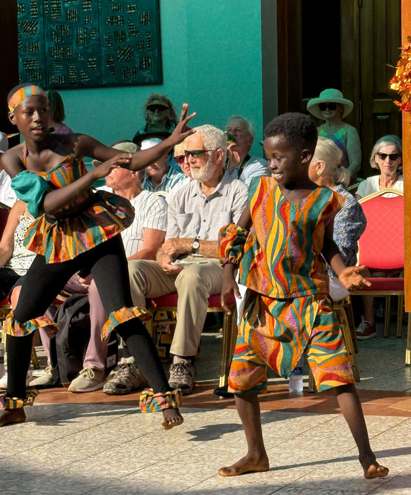
And one picture of the young boy dancer. He was very enthusiastic.
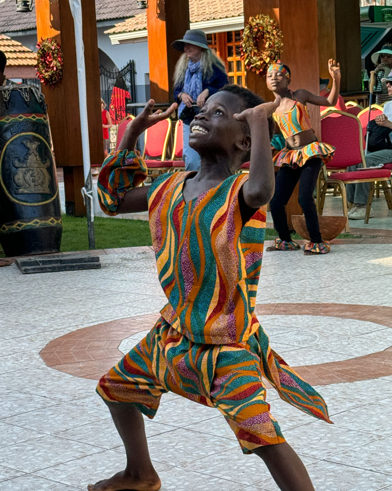
It was a good show, but it went on way too long. Judy had her ear plugs in and I had my hearing aids turned down.
We returned to the ship and had a quiet evening.
+++++++++++++++++++++++++++++++++++++++++
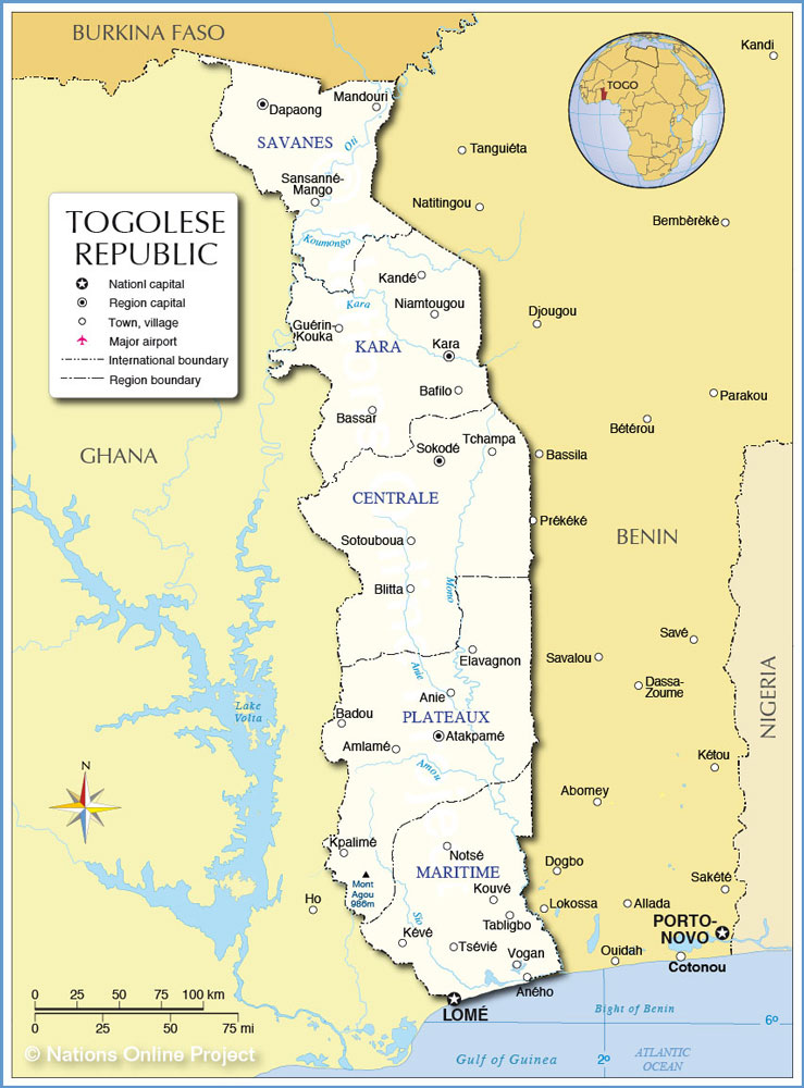
12/4/2023 (Monday) We arrived in Lomé, Togo this morning about 8:30. I'm feeling much better but Judy has caught my cold.
Togo is the third smallest country on the mainland of Africa, after Guinea-Bassau and The Gambia (that depends on whether you count the subdivisions of South Africa as countries). The official language is French. It is about 50% Christian with traditional faiths, and Islam making up the remainder. Togo was part of the Slave Coast.
It derives its name from the Togolese people who lived in the area. The official name of the country is République Togolaise, or Togolese Republic in English.
Agriculture and mining (mostly phosphate) are the main industries. In our short drive through Lomé, it did not appear to be extremely poor.
We crossed the prime meridian as we sailed to Lomé and are now in the eastern hemisphere. We will stay east of the prime meridian for the rest of the cruise.
We have a short excursion this morning. A problem with this excursion was that everyone - ten buses - all went together to the same places, which made things quite crowded.
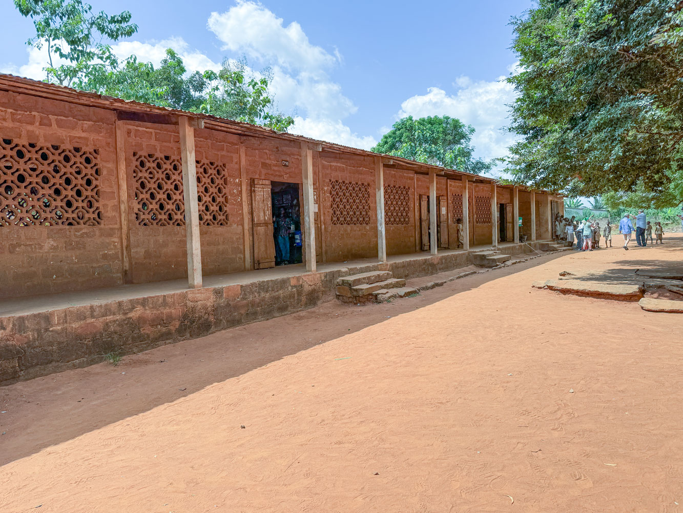
Our first stop was a school. Here's one of the buildings of the school. Open lattice-work bricks on each side wall gave ventilation and natural light.
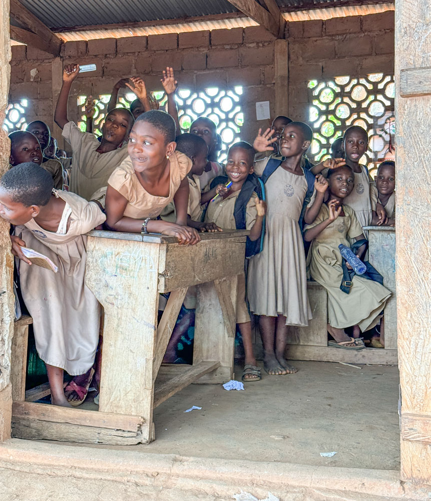
The kids were excited to see all these foreigners visiting their school. Note the desk in the picture.
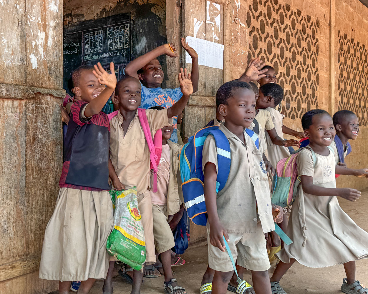
More of the kids.
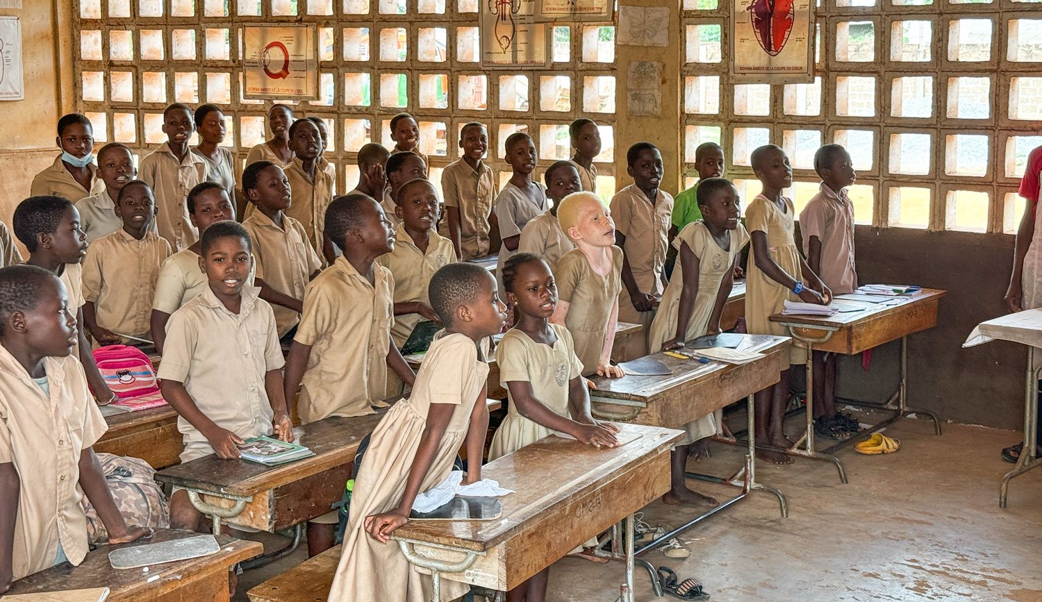
A class in progress. Looks like the girls are in the front row. One appears to have oculocutaneous albinism.
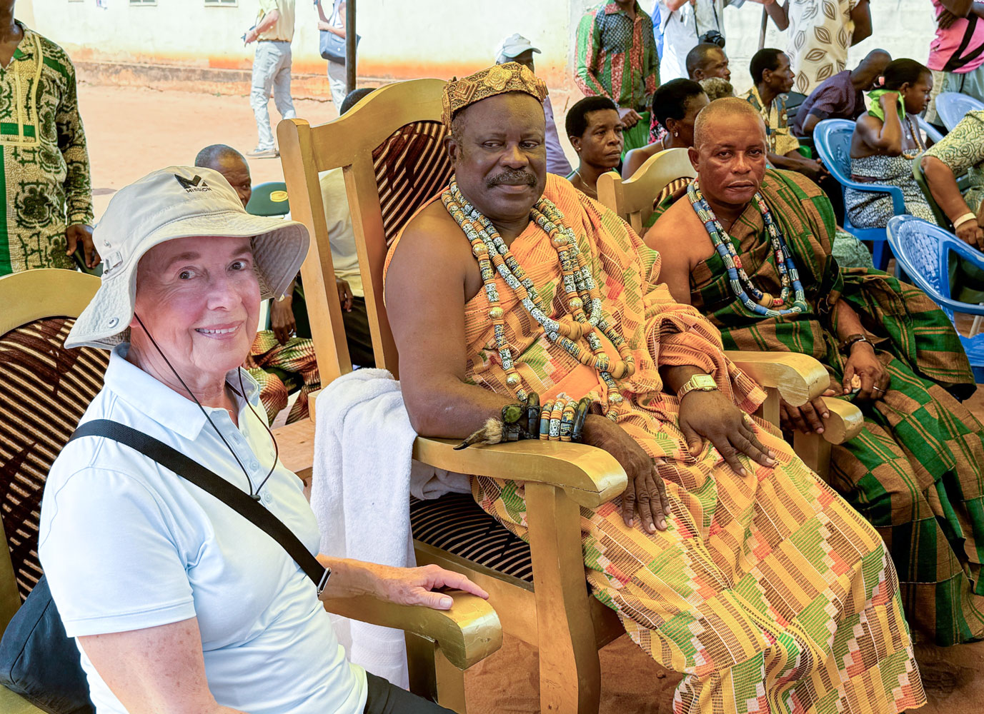
From here, we went to a village to see a ceremony that featured the king of the village. They had set up tents for us with chairs. It was fairly hot and crowded. We were in a bad place for photography so I don't have many photos to show you.
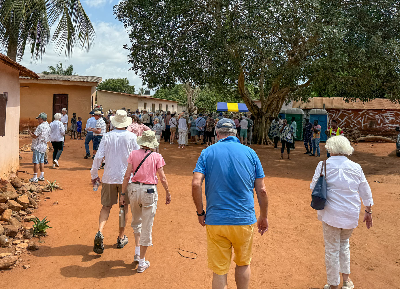
Here we are arriving at the village. You can see one of the tents in the background.
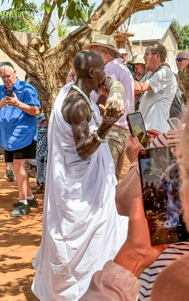
There was a drum band playing as we settled into our seats. The king and his entourage marched into the area, preceded by a man blowing an animal horn.
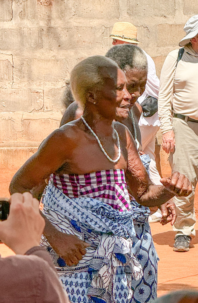
There was a group of older women dancers following, but I didn't get any good pictures because of all the people in front of me. Here's what I was able to get.
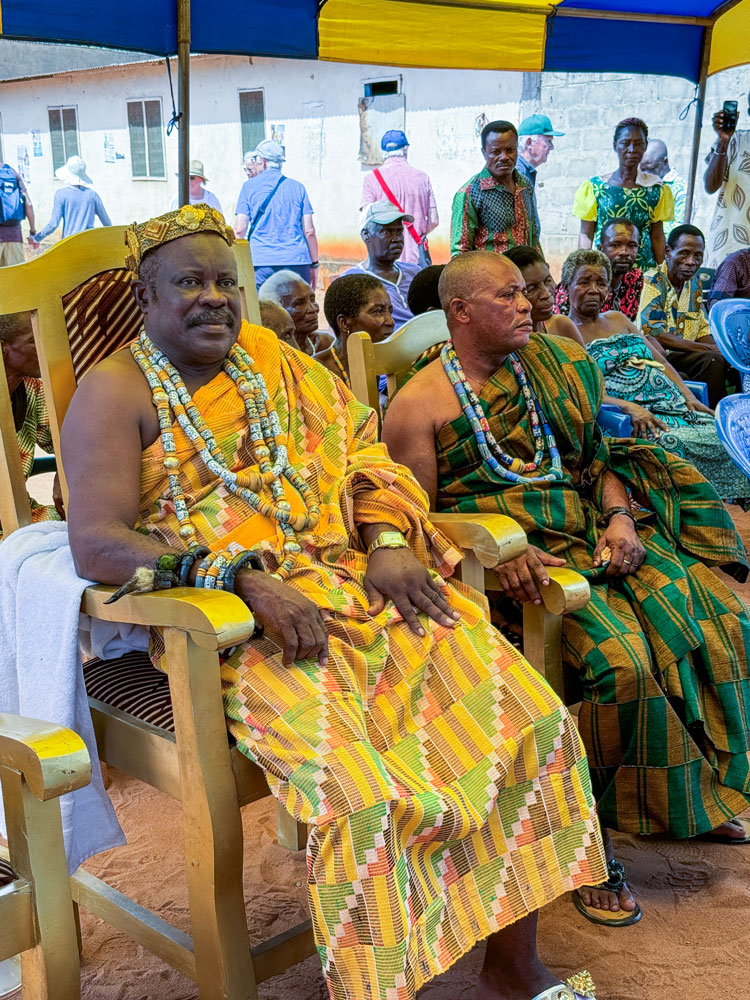
The king and his wife.
And Judy with the king.
That was the end of our excursion, and we were happy to get back to the ship and a nice shower.
Tomorrow we have a sea day as we sail to São Tomé.